The Splendid Doi Suthep – Inthanon Route Chiang Mai

Mentioning the land of mountains and morning fogs. and the name of Chiang Mai comes up first on everyone’s mind. This northern capital is resplendent with pristine nature. lofty hills. montane evergreen forests. temperate climate fruit orchards and colorful flowers all year round. The people are hospitable and friendly. For motorists. the mountain roads through rolling hills are the pleasant challenge they gladly take. especially the route up Doi Suthep and Doi lnthanon.
Doi Suthep, the symbol of Chiang Mai, can be toured by car on two routes, one leading up to the Pagoda of the Holy Relics of Doi Suthep, and over to Bhubing Palace and Doi Pui, another running around Doi Suthep from Mae Rim District through Samoeng and Hang Dong Districts. Both routes offer plenty of superb views and authentic mountain atmosphere, plus the beauty of the Lanna culture and the charms of hill-tribe lifestyles. The roads are in good condition, traveled comfortably by both 2-wheel and 4-wheel drive cars, the VIOS, ALTIS and AVANZA series. Along the way, stop to pay respect to the Monument of the venerated Khru Ba Sri Vichai, the one who initiated the road up Doi Suthep. Also, there are Huai Kaeo, Wang Bua Ban, and Mentha Than Waterfalls, lying in a walking distance from one another. Passing about 10 bends marked as “Sharp Curve”, the parking lot of the hilltop temple is reached. The temple, situated about 915 meters above mean sea level, can be accessed through a long Naga – head stairway of 306 steps, or by an electric tram service, costing 20 baht per person. Panoramic views of the city of Chiang Mai are afforded from the lookouts at four corners of the pagoda. The golden pagoda is best observed in the sunrise glow and again at sunset.

Going further from the palace on the same route for 3 kilometers, the Hmong Village of Doi Pui is reached. Here one can shop for craft items and fresh flowers and take a stroll in the peaceful atmosphere of a hill-tribe community. It is a perfect site to view the setting sun over the rolling hills in Samoeng District beyond. With time to spare and a 4-wheel drive car, take a trip to the far hill of Doi Khun Chang Khian. A rough ride through steep cliffs and hairpin bends is amply rewarded with the sight and sound of pure nature.
The Mae Sa Elephant Center is at kilometer 10. One kilometer further is the Queen Sirikit Botanic Garden, with a large collection of plants. The winding road then leads to Samoeng District, the center of native Yanda cerulean. Turning into Highway 1296, Samoeng – Hang Dong, several natural resorts are found, such as Krisda Doi, Uttayan Lanna and Suan Bua Resort, where tourists can wonder around flower gardens and have their photographs taken. Several orchid farms and butterfly gardens line the route, up to Hang Dong District, where Highway 1096 meets Highway 108, leading to the highest peak of the country, Doi lnthanon.
The route passes through alternating scenes of green mountains and deep valleys, dotted with large and small hill communities. Hang Dong District is a major craft center, with Ban Thawai Village as a famous woodcarving site.
Entering San Pa Tong District, at kilometer 29 to the left, a unique accommodation called Kao Mai Lanna can be found. The site, formerly a tobacco leaf curing factory, has been turned into a charming boutique hotel. An overnight stay is recommended. To the front is a restaurant serving delicious food, along with hand-woven textile and embroidery works by housewives’ group for shoppers.

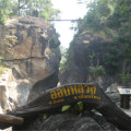
In the next morning, continue your trip on the same route. Entering Cham Thong District, sign-boards indicate the way up Dol lnthanon. Turn right on Highway 1009, a climbing mountain road with even more spectacular views on both sides. Utmost precaution and greatest driving skills are required throughout, as some stretches involve narrow path and sharp bends. Higher up, more hill-tribe communities are located, with stalls selling souvenirs, conserved fruits, vegetables and flowers. There are several major waterfalls. including Mae Ya, Mae Klang, Vajirathan, and Siribhum waterfalls. At an elevation of almost 2,400 meters, two hilltop shrines are located, the Holy Relics of Nabhamethanidol and the Holy Relics of Naphabolbhumisiri, built by the Royal Thai Air Force as tributes to His Majesty the King and Her Majesty the Queen on two significant royal anniversaries. From the balconies around the two pagodas, take in superb views of the entire area surrounded by the Thanon Thongchai Mountain Range.

Doi lnthanon Park Headquarters is located at kilometer 31. Opposite the park office is Uncle Oaeng’s shop, the center for bird-watchers, adorned with line shots of wild birds. The route ends at the highest parking lot in the country, located at 2,565 meters above sea level, with a sign of “The Highest Point of Slam”, the most photographed spot. A stupa containing the ashes of Prince lnthawichayanond, the last ruler o f Chiang Mai is situated in the area. The environment is that of the ancient jungle as the continuation of the foothills of the Himalaya from the north. Trees are covered with green moss. Coming here during November to February, you stand good chance of spotting bright red wild roses, known as the thousand-year rose. Walking down about 200 meters to the right, there is a nature study trail, as an extended wooden bridge into the wilderness.

Chiang Mai Map Thailand
Thailand Travel Guide:
Category: Chiang Mai